Paris Map - Center - French
Paris Map - Center - French
(111x71cm)
Couldn't load pickup availability
Shipping Info
Shipping Info
- All posters ship within 1–2 business days
- Each poster includes an individually signed Certificate of Authenticity. More Info
Buy with Confidence
Buy with Confidence
Returns accepted within 7 days of receipt. See our full return policy.
FAQs
FAQs
See answers to our most common questions, here
Looking to Sell?
Looking to Sell?
We are always interested in acquiring special pieces. Let's get in touch!
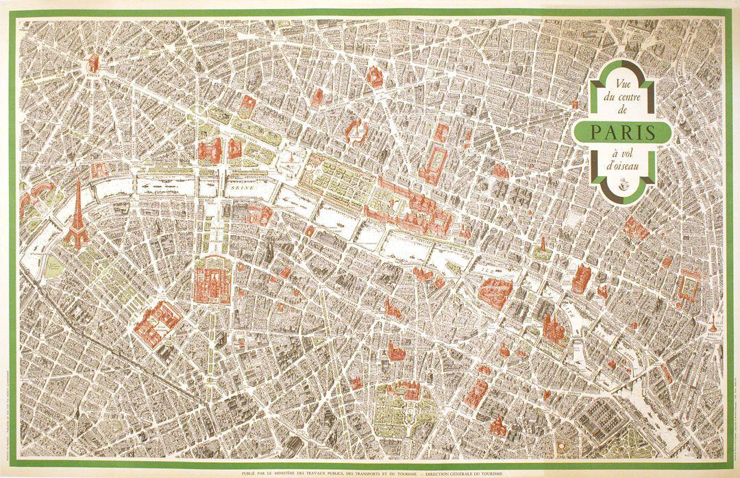
This is an original map view of Paris from the Air in 1959 showing the central part of Paris with key buildings and sites highlighted. Not only is it informative, it is very interesting to see what Paris was like almost 60 years ago. This is the French text version, it was printed in English as well.
This is an Original Map; it is not a reproduction. This map is conservation mounted, linen backed, and in excellent condition. We guarantee the authenticity of all of our items.


What Does 'Original' Mean?
We only deal in original vintage posters, never reproductions. This means that every poster is from the original print run, in the year listed in the description. Everything we sell comes with an individually signed certificate of authenticity, which we fully guarantee.


