Skip to product information
1 of 1

La Normandie - France Map

La Normandie - France Map

Authenticated Original
Over 30 Years in Business

Hetreau
1955
35.5"x25"
(90x64cm)
3395
Regular price €647,95 EUR
Regular price Sale price €647,95 EUR
Sale Sold out
Shipping calculated at checkout.

Shipping Info

  • All posters ship within 1–2 business days
  • Each poster includes an individually signed Certificate of Authenticity. More Info

Buy with Confidence

Returns accepted within 7 days of receipt. See our full return policy.

FAQs

See answers to our most common questions, here

Looking to Sell?

We are always interested in acquiring special pieces. Let's get in touch!

This charming map depicts the most significant places found throughout France’s Normandy region. From the notable Omaha and Utah beaches famed for their D-Day landings, to its picturesque villages and countryside, Normandy offers a quaint blend of beauty and history. This poster was published by France’s Ministry of Public Works, Transport and Tourism and the General Direction of Tourism and the Federation of Tourist Unions of Normandy in 1955, when tourism became greatly in-demand post World War II.

Raymond Hétreau (1913-2001) was a French illustrator and poster artist who designed vibrant, expressive commercial posters for numerous clients. His work captures the free-spirited nature of post-war French culture.

This is an Original Vintage Poster; it is not a reproduction. This poster is conservation mounted, linen backed, and in excellent condition.

We guarantee the authenticity of all of our posters.

View full details
Orangina Vintage Posters

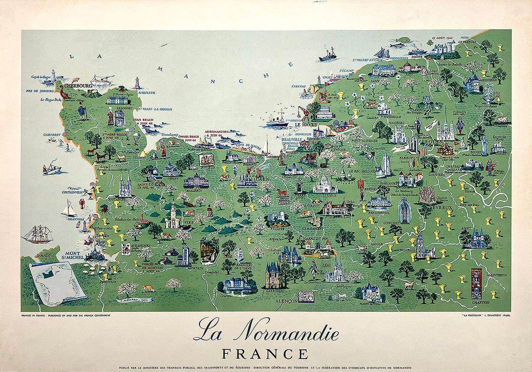
What Does 'Original' Mean?

We only deal in original vintage posters, never reproductions. This means that every poster is from the original print run, in the year listed in the description. Everything we sell comes with an individually signed certificate of authenticity, which we fully guarantee.

Learn More